Intelligent Public Transportation Systems
How Do I Go?
The New Face of Transportation in Smart Cities
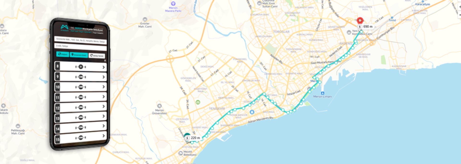
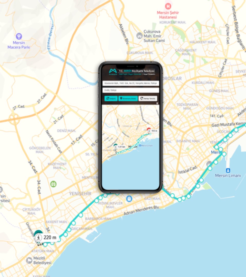
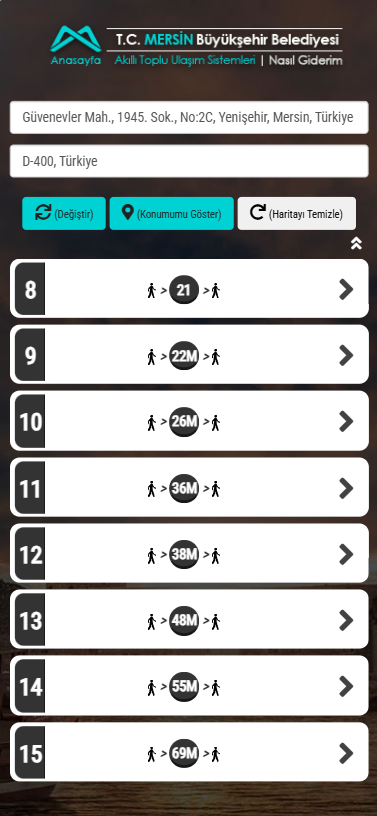
Wondering how to get to your destination in the fastest and easiest way? The “How Do I Get There?” module instantly calculates the most suitable public transport route for you!
All you need to do is select your starting point and destination. Our system analyzes bus lines, stop locations, and transfer points to provide you with the fastest and most practical route. You can also get information on alternative routes.
No more getting lost, no more getting on the wrong bus! With “How Do I Get There?”, your urban journeys become much easier.
👥 What Do Citizens Gain?
Safe transportation without the risk of getting lost
Reaching their destination in less time
Awareness of alternative transportation options
Better control over transportation costs
Evaluation of eco-friendly travel options
🏙️ What Do the Municipality and Transportation Authority Gain?
Generation of passenger density and demand maps
Route and schedule optimization
Enrichment of data through citizen feedback
More efficient use of transportation infrastructure
Contribution to the smart city vision